
THE LAKE AND THE LAND
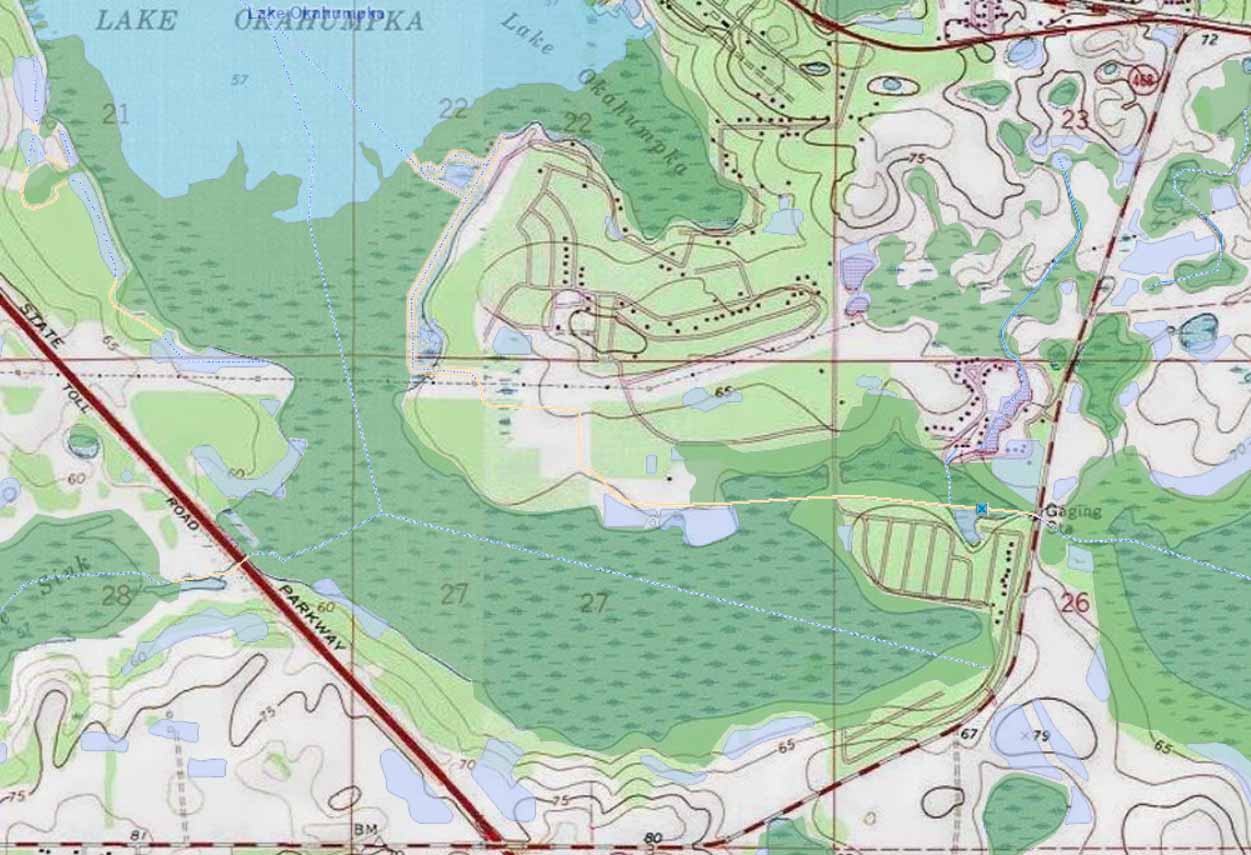
USGS Topographic Survey Map
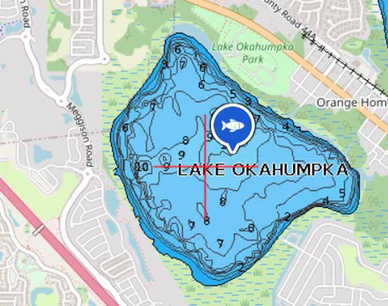
Click below image for Lake Okahumpka depth and fishing info.
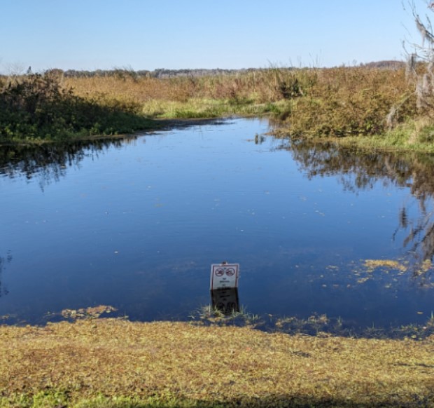
Tussocks on Lake Okahumpka.
Click on image to read report
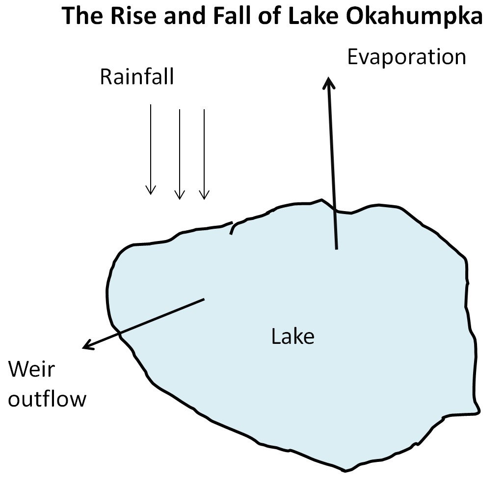
The Rise and Fall of lake Okahumpka
Click on image to read report
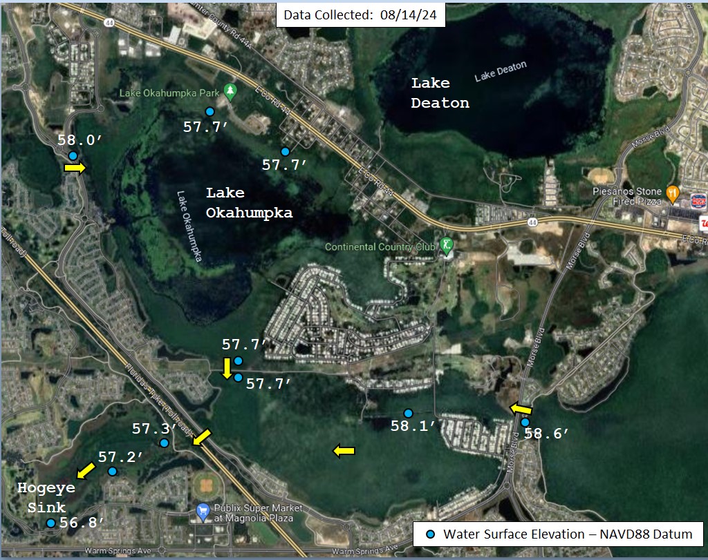
Lake Okahumpka High Water Investigation by SWFWMD post Hurricane Debby Aug 2024
click image to view report
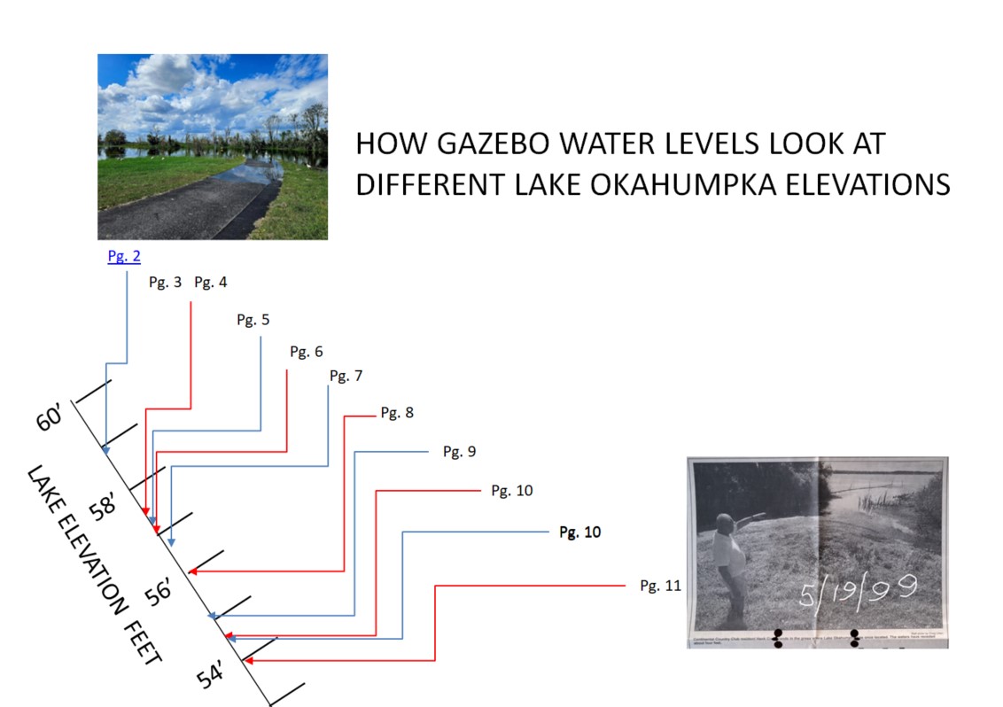
HOW GAZEBO WATER LEVELS LOOK AT DIFFERENT LAKE OKAHUMPKA ELEVATIONS
See the Measured Lake Level at the CCC Dock
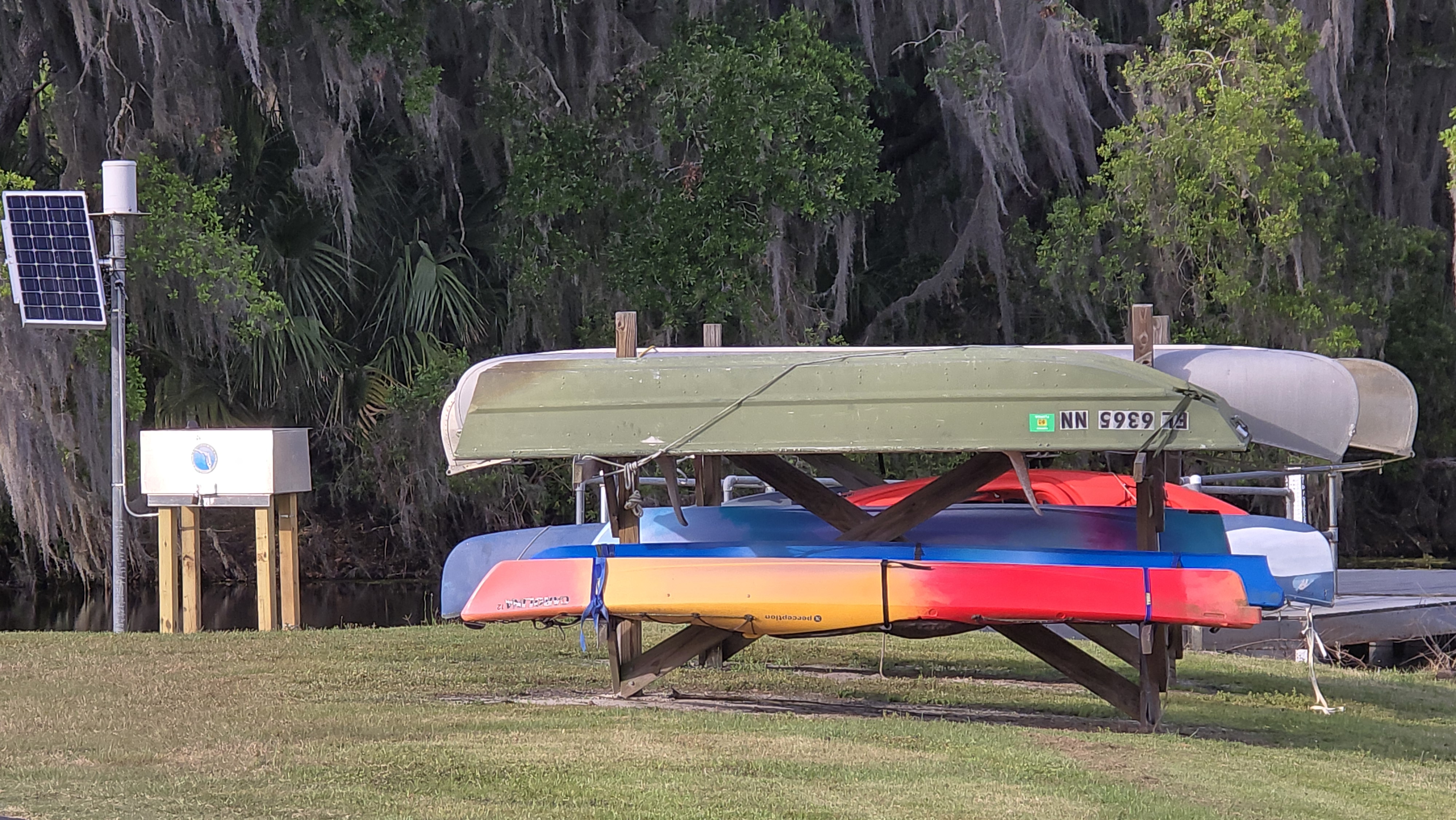
(CLICK IMAGE FOR DATA) Image shows the Lake Okahumpka water level gauge ( submerged sensor) system at the CCC Dock. Hourly elevation measurements are sent to SWFWMD for records and review. Data collection started March 28, 2025
See the Measured Rainfall at the CCC Dock
(CLICK IMAGE FOR DATA) Image shows the Lake Okahumpka Rainfall gauge system (small barrel on top) at the CCC Dock. Continuous accmulated measurements during each day are sent to SWFWMD for records and review. Rainfall was measured adjacent to the CCC Waste Water Treatment plant from 2000- 2025 (March 28th)
See the Measured Lake Level at the weir Structure
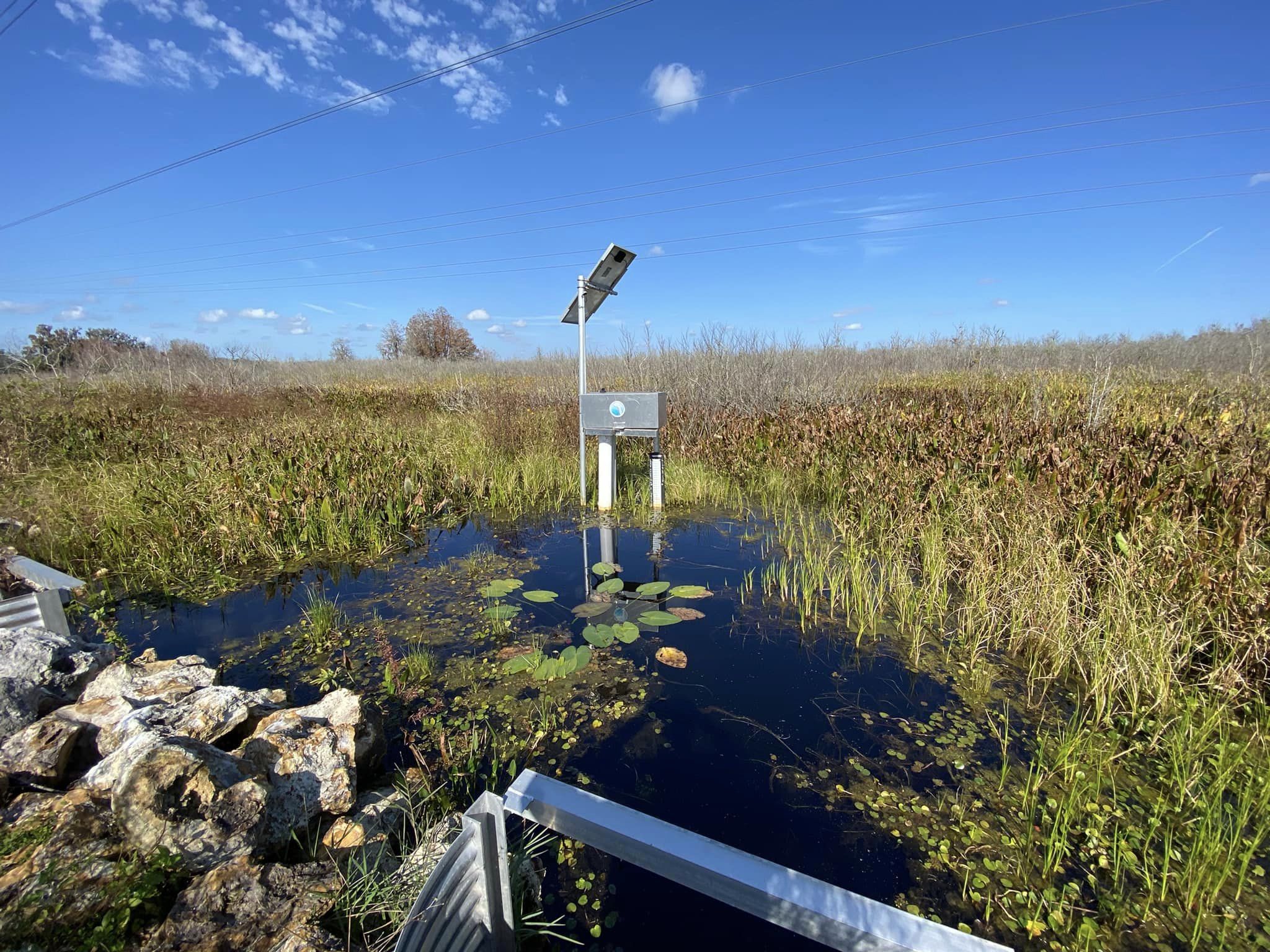
(CLICK IMAGE FOR DATA) Image shows the Lake Okahumpka water level gauge system (since removed) at the weir structure. Hourly elevation measurements were sent to SWFWMD from 2021-2025 (March 28th) for records and review.

SWFWMD EXPLAINS HIGH LEVELS AFTER HURRICANE DEBBY (August 2024)

The floridian aquifer and the green swamp. Note how this relates to our water levels during storm season.